
The narrow cobblestone streets of Le Marais wind unpredictably between medieval buildings, while the grand boulevards radiating from l’Étoile demand confidence and precision. As you contemplate driving through Paris for the first time—or perhaps reclaiming the streets after relying solely on the métro—one question emerges: can you trust Waze to guide you through this magnificent yet occasionally maddening city?
Yes, Waze is not only available in Paris but thrives here. In fact, the crowd-sourced navigation app was designed in Israel and gained popularity throughout Europe before even launching in the United States. With millions of active French users contributing real-time data, Waze has become an indispensable tool for navigating Paris’s complex traffic patterns, understanding its unique driving culture, and avoiding the city’s notorious embouteillages.
Yet using Waze in Paris requires more than simply downloading the app and following the blue line. The City of Light presents unique navigational challenges—from understanding French speed limit conventions to navigating the legal complexities around radar detection. Here’s your complete guide to mastering Waze in the world’s most romantic capital, compiled from years of Parisian driving experience and insights from local Wazers who know these streets intimately.
1. Download and Configure Before You Arrive

The Seine glitters beneath you as your plane descends toward Charles de Gaulle, and already you’re thinking about that first drive into the city. Don’t wait until you’re collecting your rental car to set up Waze—prepare your digital navigator while still on solid ground.
Waze is free to download from both the Apple App Store and Google Play Store, requiring iOS 10 or Android 10 or above. The French version of the app appears in app stores as “Navigation Waze et trafic,” though the interface seamlessly adapts to your phone’s language settings. Download the app before departure, allowing you to familiarize yourself with its features without the pressure of immediate navigation.
During initial setup, grant Waze access to your location services and enable background app refresh. This ensures the app can track traffic patterns and provide accurate routing even when running in the background. Connect to WiFi at your hotel or apartment before venturing out, allowing the app to cache essential map data for the Paris region. While Waze requires an active data connection to function optimally, this pre-loading reduces data consumption during navigation.
Consider downloading the app at least a week before your trip. Spend time exploring its features while planning your Paris itinerary—enter potential destinations, study alternative routes, and become comfortable with the interface. This advance preparation transforms Waze from an intimidating necessity into a confident companion for your Parisian adventures.
2. Understand the Data Plan Reality
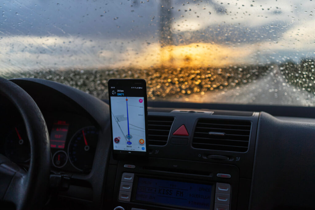
Waze lives and breathes on real-time data. Unlike traditional GPS systems that function offline, this community-driven app constantly communicates with servers, pulling in live traffic updates, road closures, and user-reported incidents while simultaneously sharing your driving data to help others. This symbiotic relationship requires a reliable data connection—and in Paris, that means planning ahead.
For visitors from outside the European Union, international roaming charges can transform a simple drive across Paris into an expensive proposition. A 30-minute journey using Waze typically consumes between 5-10 megabytes of data, though this varies based on route complexity and the frequency of rerouting. Over a week of daily driving, expect to use 200-300 megabytes—modest by modern standards, yet potentially costly without proper preparation.
Contact your mobile carrier before departure to explore international data options. Many providers now offer affordable European data packages specifically designed for travelers. Alternatively, consider purchasing a local French SIM card upon arrival.
Providers like Orange, SFR, and Bouygues offer tourist-friendly prepaid options with generous data allowances, typically costing €20-30 for two weeks of service with 20-50GB of data—more than sufficient for extensive Waze usage plus general internet needs.
The investment in proper data coverage pays dividends beyond navigation. With reliable internet access, you can spontaneously search for parking, discover nearby cafés when hunger strikes, and share your arrival time with dinner companions—all while Waze quietly guides you through Parisian traffic in the background.
3. Master the French Speed Limit System
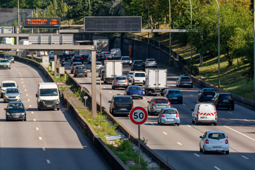
Perhaps no aspect of French driving culture confounds visitors more thoroughly than the seemingly mysterious speed limit system. Unlike the explicit signage prevalent in North America, French roads operate on implied limits based on road type, and Waze becomes your essential translator for this unspoken language.
French speed limits follow clear patterns, though they’re rarely posted with American-style frequency. On autoroutes (highways), the limit is 130 km/h in dry conditions, automatically reducing to 110 km/h when rain dampens the pavement. Ring roads like the Boulevard Périphérique maintain 70 km/h limits, while residential streets default to 50 km/h within city limits—even when no sign announces this expectation.
Here’s where Waze proves invaluable: the app displays current speed limits in real-time, adjusting for weather conditions and road types. Watch the small circular indicator in the lower corner of your screen—it shows the current limit and changes color when you exceed it, providing gentle visual feedback without the jarring alerts that might distract from driving.
However, understand a crucial distinction: Waze shows speed limits but cannot perfectly predict every variation. When entering small towns and villages, the town entrance sign itself serves as the speed limit notification, immediately reducing permitted speeds to 50 km/h. Waze typically recognizes these transitions, but occasionally updates lag by several seconds. Develop the habit of watching for town entrance signs (blue rectangular signs with the town name) and automatically reducing speed regardless of what Waze displays.
French police take speed enforcement seriously, with automated cameras positioned throughout Paris and its surrounding autoroutes. Exceeding limits by even 5 km/h can trigger citations, with fines automatically sent to rental car companies that pass charges to drivers. The cost isn’t merely financial—speeding violations interrupt the rhythm of a Parisian adventure, replacing carefree exploration with bureaucratic frustration.
A peculiar tension exists in the French relationship with speed cameras. While these automated enforcers dot the landscape with impressive density, French law prohibits applications from specifically identifying camera locations. This legislation, enacted in 2012, dramatically altered how navigation apps operate in France—and understanding this change prevents confusion when using Waze.
Before 2012, Waze displayed precise camera locations with specific icons indicating whether the camera monitored speed, red lights, or both. Today, French users see only generic “police reported” icons in areas where cameras exist. The app shows a small police badge symbol accompanied by the phrase “zone de danger” (danger zone) rather than explicitly identifying the enforcement mechanism.
This legal workaround preserves Waze’s core functionality while technically complying with French law. The app warns you of areas requiring extra vigilance without specifically confirming camera presence. For practical purposes, treat every “police reported” notification as if a camera exists—because in most cases, one does.
Interestingly, this restriction only applies within French borders. If you use the same Waze app in Belgium, Germany, or other European countries during your travels, full camera information magically reappears. The app geofences these features based on your location, automatically adjusting display protocols to match local regulations.
Some travelers consider activating VPN services to circumvent these restrictions, theoretically making the app believe you’re navigating from a country without radar display limitations. However, this approach is legally questionable and practically unnecessary. The “danger zone” warnings provide sufficient information to drive safely and legally throughout Paris—focus instead on enjoying the journey rather than gaming the system.
See Related: How to Plan a Surprise Trip to Paris: The Ultimate Insider Guide
5. Embrace the Parisian Driving Culture
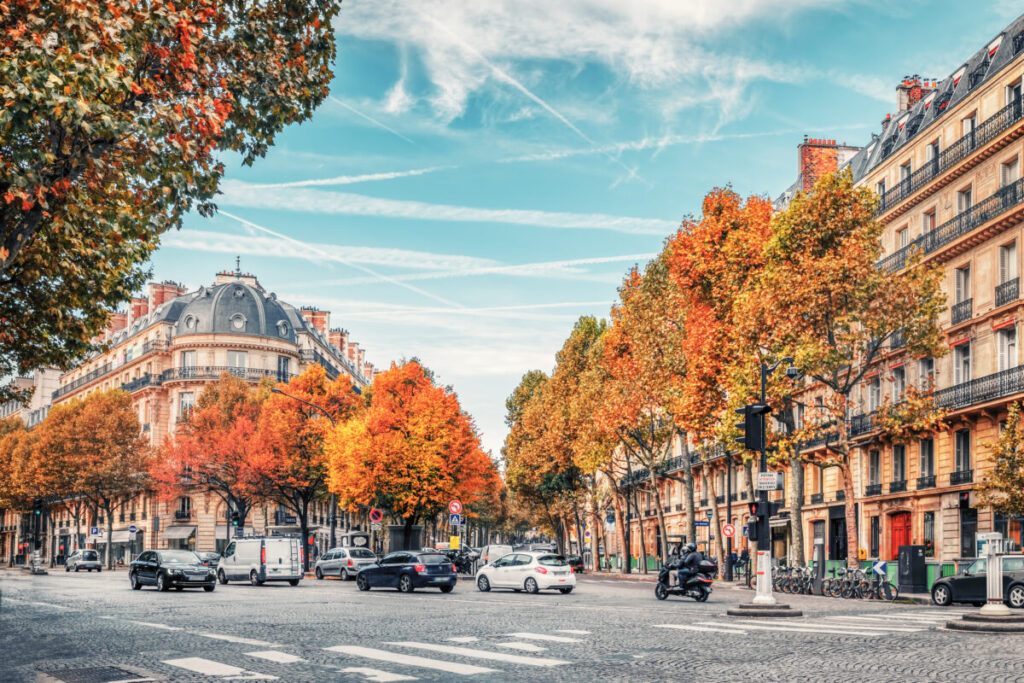
Using Waze effectively in Paris requires more than technical proficiency—it demands understanding the city’s distinctive driving personality. Parisian motorists have earned their reputation for aggressive driving, though this characterization oversimplifies a complex urban traffic culture that balances efficiency with occasional chaos.
Paris operates on an unwritten hierarchy of right-of-way that occasionally contradicts posted regulations. Roundabouts (traffic circles) present particularly instructive examples.
While official rules grant priority to vehicles already in the circle, Parisian drivers often assertively merge regardless of existing traffic, trusting others to adjust. This ballet of mutual adaptation can seem chaotic to visitors accustomed to more rigid traffic patterns.
Waze helps navigate this environment by providing advance warning of upcoming roundabouts and complex intersections. The app’s lane guidance feature—showing which lane to occupy for upcoming turns—proves especially valuable in Paris, where last-minute lane changes can trigger a chorus of horns from drivers who maintain mere centimeters of separation.
The city’s narrow streets, particularly in historic neighborhoods like Le Marais and Montmartre, present additional challenges. Cars park with remarkable precision, utilizing every available centimeter of curb space. Streets barely accommodate two vehicles passing simultaneously, requiring one driver to pull aside into parking indentations—a dance of negotiation and courtesy that Waze can’t directly facilitate but indirectly supports by choosing routes appropriate for your vehicle size.
Enable Waze’s vehicle type setting to indicate whether you’re driving a standard car ora larger vehicle. This allows the app to avoid streets where your vehicle might struggle to pass or park. While Parisian drivers seem to navigate their Citroëns and Peugeots through impossibly tight spaces, rental cars often have less forgiving dimensions.
6. Decode the Parking Challenge
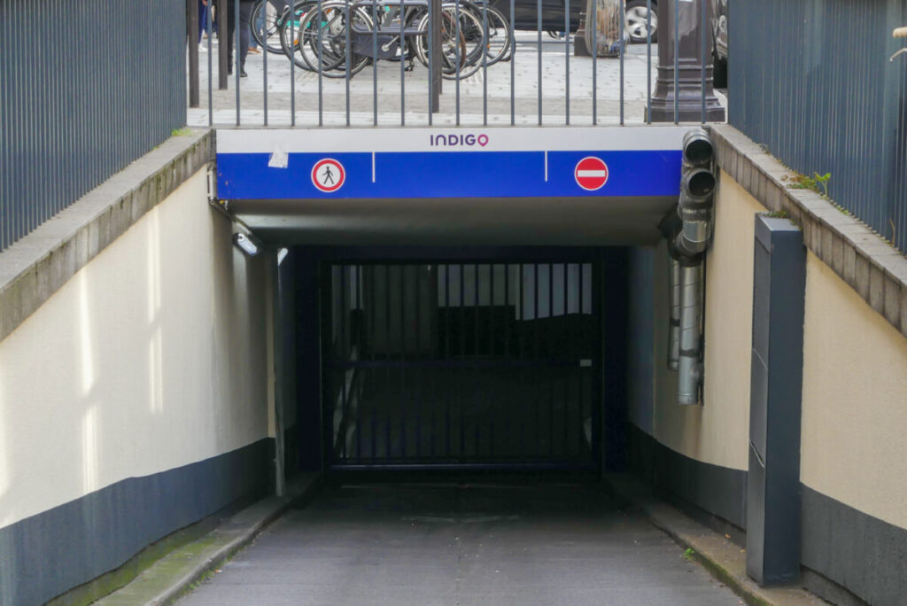
Finding parking in Paris ranks among the city’s most frustrating challenges, transforming a delightful dinner reservation into a stressful odyssey through endless streets of occupied spaces. Waze offers features specifically designed to address this Parisian nightmare, though success requires understanding both the app’s capabilities and the city’s parking ecosystem.
Waze includes parking lot location features, showing nearby parking structures with estimated availability and pricing when available. Activate this feature by tapping the parking icon (usually a “P” symbol) near your destination. The app displays public parking options, though real-time availability data varies in accuracy—French parking operators inconsistently share occupancy information with third-party applications.
More valuable than parking lot locations, Waze helps identify neighborhoods where street parking might exist. Study the app’s traffic patterns as you approach your destination. Streets showing slower speeds often indicate available parking or at least legal parking zones worth investigating. However, Parisian street parking operates under complex regulations that Waze cannot fully interpret.
Blue zone parking (horodateurs) requires payment during specified hours, typically Monday through Saturday from 9:00 AM to 8:00 PM. Payment machines accept coins and increasingly credit cards, though some older machines remain coin-only. The cost ranges from €2-4 per hour depending on arrondissement, with central areas (1st through 8th) commanding premium prices.
Residential parking zones (marked with signs reading “Réservé aux résidents”) prohibit tourist parking entirely. These zones, indicated by street signs showing a vehicle symbol with “Sauf Résidents” underneath, trigger hefty fines when violated. While Waze cannot identify these zones on maps, its community-reported information sometimes includes warnings about aggressive parking enforcement in residential areas.
Perhaps Waze’s most useful parking feature remains its ability to remember where you parked. After parking, tap the parking icon and select “Remember parking location.” This drops a pin at your vehicle’s location, invaluable when returning from dinner in an unfamiliar neighborhood after several glasses of Bordeaux have slightly blurred your spatial memory.
7. Utilize the Carpool Lane Intelligence
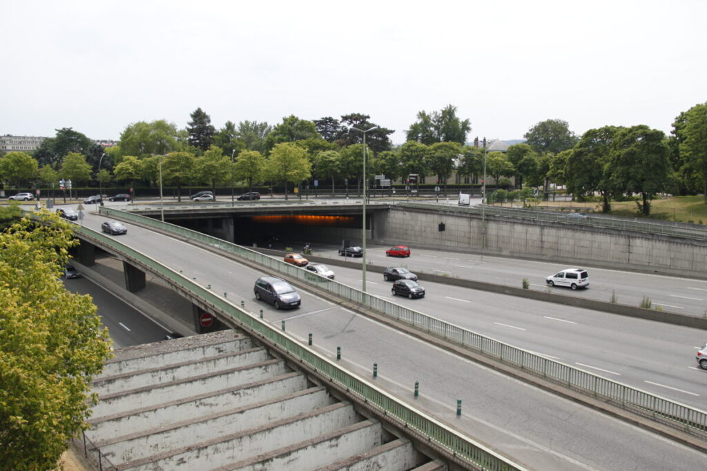
The Boulevard Périphérique, Paris’s ring road, circles the city like a concrete necklace, connecting all major highways radiating from the capital. During rush hours, this vital artery transforms into a slow-moving parking lot, with commuters inching toward their destinations at frustrating speeds. In recent years, Paris has implemented carpool lanes to encourage shared transportation—and Waze helps navigate this evolving infrastructure.
Carpool lanes on the Périphérique (voies réservées au covoiturage) operate during weekday rush hours, typically 6:30-9:30 AM and 4:30-8:00 PM. These lanes, marked with diamond symbols on the pavement and overhead signage, require vehicles to carry at least two occupants. Enforcement combines automated cameras with occasional police checks, making violations costly propositions.
Waze includes settings to indicate your passenger count, allowing the app to suggest carpool lane usage when beneficial. Access this feature through Settings > Navigation > HOV/Carpool lanes, then specify your vehicle occupancy. When the app detects that you meet carpool lane requirements and the lane offers time savings, routing suggestions incorporate these faster options.
However, understand that Waze’s carpool lane guidance requires active user participation. The app doesn’t automatically count passengers or verify eligibility—you must honestly indicate occupancy.
Additionally, Waze sometimes suggests carpool lanes even when time savings prove marginal. Use judgment when deciding whether brief time savings justify the stress of lane changes in dense Périphérique traffic.
For solo drivers, Waze helps avoid accidental carpool lane violations by displaying lane restrictions. When navigation suggests routes along the Périphérique during rush hours, the app indicates which lanes remain available for single-occupant vehicles. This prevents the common tourist mistake of inadvertently entering restricted lanes while following general traffic flow.
8. Leverage Community Reports Wisely

Waze’s greatest strength emerges from its community-driven reporting system. Millions of users worldwide contribute real-time information about road conditions, creating a dynamic map that responds to changing circumstances within minutes. In Paris, this crowdsourced intelligence proves particularly valuable given the city’s propensity for sudden road closures, demonstrations, and special events.
The app allows you to report various incidents while driving: accidents, disabled vehicles, objects on the road, traffic jams, and police presence. In Paris, users enthusiastically contribute these reports, creating an unusually current picture of road conditions. However, the system’s effectiveness depends on careful interpretation and responsible contribution.
When viewing community reports, consider their age and verification status. Fresh reports (less than 30 minutes old) indicated by bright colors deserve attention, while older reports marked by faded icons might reflect resolved situations. Multiple users confirming the same incident increases reliability—a single report of traffic congestion might reflect one driver’s perspective, while five confirmations suggest genuine problems ahead.
Contributing your own reports enhances the community while potentially improving your own navigation. Waze rewards active contributors with points and rank increases (from Wazer Baby through King of the Road), though these gamification elements appeal more to some drivers than others. More importantly, reporting helps fellow travelers avoid problems you’ve encountered, continuing the cycle of community assistance that makes the app valuable.
However, exercise caution when submitting reports while driving. French law strictly prohibits mobile phone handling while operating vehicles, with exceptions only for hands-free navigation.
If you wish to report an incident, use voice commands (“OK Waze, report traffic” or “OK Waze, report accident”) rather than touching your screen. Alternatively, wait until safely stopped before contributing reports—community service shouldn’t come at the expense of safety.
Paris’s community reports often include cultural elements absent from other cities. Users frequently report “manifestation” (demonstration) locations, warning drivers to avoid areas where protests might impede traffic. During national strikes affecting public transportation, Waze reports sometimes include commentary about alternate routes or parking near métro stations—local knowledge that transcends the app’s primary navigation function.
See Related: Best Things to do Near the Eiffel Tower
9. Master the Multi-Stop Journey Planning
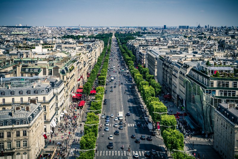
Paris rewards explorers who venture beyond single-destination thinking. A perfect day might include morning coffee in Saint-Germain-des-Prés, midday museum visits in the Marais, afternoon shopping along the Champs-Élysées, and evening dinner in Montmartre. Connecting these experiences efficiently requires multi-stop journey planning—a Waze feature that transforms scattered destinations into logical itineraries.
Waze allows adding multiple stops to a single journey, automatically calculating optimal routes between waypoints. After entering your primary destination, tap “Add stop” to include additional locations.
The app sequences these stops in order entered, though you can drag and reorder them to optimize routing. This feature proves particularly valuable when planning shopping expeditions or tourist itineraries involving multiple attractions.
However, understand that Waze’s multi-stop routing prioritizes shortest travel time rather than geographical logic or scenic value. The app might route you from the Marais to Montmartre via the Périphérique when a more pleasant journey through charming neighborhoods exists. For destinations requiring specific arrival times (restaurant reservations, museum entry tickets), verify individual leg duration and build flexibility into your schedule.
Consider creating separate routes for different parts of your day rather than loading all destinations into a single itinerary. Morning routes focusing on one arrondissement, afternoon exploration of another area, and evening destination planning provide more flexibility when spontaneous discoveries interrupt schedules—as they should in Paris.
The app integrates with your phone’s calendar, allowing seamless navigation to appointments. When calendar events include location information, Waze can automatically calculate departure times, ensuring timely arrival. This proves particularly valuable for pre-booked tours, restaurant reservations, or theater tickets requiring prompt attendance.
10. Integrate Audio Entertainment Without Distraction

Long Parisian traffic jams—an unfortunate reality of urban driving—need not translate into wasted time. Waze partners with multiple audio streaming services, allowing seamless podcast listening, music playback, and audiobook enjoyment without leaving the navigation interface. This integration enhances the driving experience while maintaining focus on the road ahead.
The app supports Spotify, Deezer, YouTube Music, Apple Music, and various podcast platforms, with availability varying by device type and region. Access these features through Waze’s audio player integration, controlled via the small icon in the lower corner of the navigation screen. The interface allows basic playback control—play, pause, skip—without switching applications or removing Waze from view.
This integration proves particularly valuable during longer drives outside Paris. When visiting Versailles, Fontainebleau, or Champagne region vineyards, journey times extend beyond typical city navigation. Background entertainment transforms these drives from tedious obligations into enjoyable transitions between experiences.
French radio also deserves consideration for visitors seeking cultural immersion. France Inter and Radio Nova offer talk programming showcasing contemporary French discourse, while FIP provides eclectic music programming beloved by Parisians. These stations, accessible through your phone’s radio apps, offer linguistic practice and cultural context unavailable from familiar music libraries.
However, balance entertainment with navigational awareness. Lower volume levels when approaching complex intersections, roundabouts, or areas requiring heightened attention. Waze’s voice guidance should always remain audible above entertainment sources, ensuring you don’t miss crucial turn notifications while absorbed in a particularly compelling podcast episode.
11. Respect the Environmental Zones
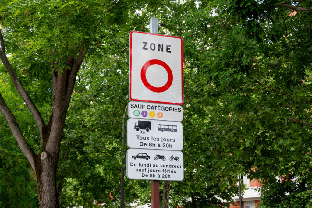
Paris has emerged as a leader in urban environmental policy, implementing increasingly strict regulations governing vehicle access to the city center. Understanding these restrictions—and Waze’s role in navigating them—prevents costly violations while supporting sustainable urban transportation policies.
The Crit’Air system classifies vehicles based on emission standards, with color-coded stickers indicating environmental categories. Vehicles receive classifications from Crit’Air 0 (electric, hydrogen) through Crit’Air 5 (the oldest, most polluting vehicles), with higher numbers facing increasing restrictions. The inner Paris zone (roughly corresponding to the first 20 arrondissements within the Périphérique) implements regular restrictions, particularly during high-pollution events.
Rental cars should include appropriate Crit’Air stickers, though verifying this before leaving the rental facility prevents later complications. The sticker displays on your windshield, visible to automated camera enforcement systems monitoring zone boundaries. Without proper classification stickers, entering restricted zones triggers automatic fines—€68 for passenger vehicles, escalating for repeated violations.
Waze displays environmental zones on its map interface, showing restricted areas with colored overlays. The app considers your vehicle’s Crit’Air classification (if entered in vehicle settings) when calculating routes, automatically avoiding zones where your vehicle cannot legally travel. This proves particularly valuable during high-pollution events when temporary additional restrictions activate with little notice.
Recent Paris policies increasingly favor pedestrians, cyclists, and public transportation over private vehicles. The city systematically reduces parking availability, narrows roadways, and expands pedestrian zones—changes that Waze quickly incorporates into routing algorithms. These policies reflect a broader French commitment to sustainable urbanism, transforming Paris from a car-centric metropolis into a human-scaled city.
Consider whether driving serves your Parisian adventures better than alternative transportation. The métro, while occasionally crowded, provides fast, affordable access throughout the city. Vélib’s bike-sharing offers delightful neighborhood exploration impossible from car windows. When driving proves necessary—trips to Versailles, airport transfers, grocery shopping—Waze optimizes these journeys while respecting environmental regulations shaping modern Paris.
See Related: Give Me 24 Hours in Paris, and I’ll Show You the Real City
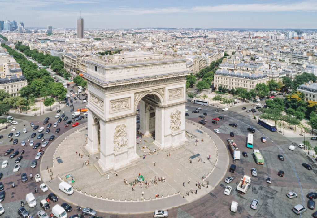
As evening light filters through the trees along the Champs-Élysées and you successfully parallel park on your third attempt, Waze has proven its worth as more than merely a navigation tool—it’s become your translator for Parisian driving culture, your guide through regulatory complexity, and your connection to a community of local drivers who’ve mastered these streets before you.
The app cannot replicate the intimate knowledge earned through years of Parisian residence, nor can it capture the ineffable pleasure of discovering a hidden courtyard after taking an unplanned turn. However, Waze provides the foundation upon which confident urban driving builds—real-time information, community wisdom, and reliable routing that allows you to focus on the experience rather than anxiously studying maps.
Download the app before departure, secure reliable data coverage, and invest time understanding French driving conventions. Approach Parisian traffic not with trepidation but with respectful curiosity, recognizing that this city’s driving culture reflects broader French values of efficiency, self-reliance, and communal adaptation. Allow Waze to handle the logistics while you absorb the magnificent chaos unfolding through your windscreen—the motorcycles threading impossibly tight gaps, the pedestrians who believe crosswalks confer invincibility, the delivery vans that park wherever loads require unloading.
Paris from behind the wheel offers perspectives unavailable to métro riders or tour bus passengers. You’ll discover neighborhoods, tourist itineraries, overlooks, experience the city’s rhythm at street level, and develop intimate knowledge of Parisian geography that transforms you from visitor into temporary resident.
Waze makes this exploration possible, providing the confidence to venture beyond familiar arrondissements toward adventures waiting in the city’s overlooked corners. Bon voyage, and may your Parisian drives prove as memorable as your destinations.
Find Things to Do in Paris
Find Accommodation

Continue Planning Your Paris Trip

Do US Citizens Need a Visa to Visit Paris? Essential Rules to Know
Planning a trip to the City of Light? Good news—visiting Paris is pretty easy for Americans. US citizens…
Read Guide →
Paris vs Bordeaux: Which City Is Better for Your Trip?
Torn between Paris and Bordeaux with limited days? How to split your time between the capital's icons and…
Read Guide →
Navigating Louvre Ticket Confusion: What You Need to Know
Double-booked the Louvre and Eiffel Tower for the same time slot? Why neither lets you modify, and your…
Read Guide →